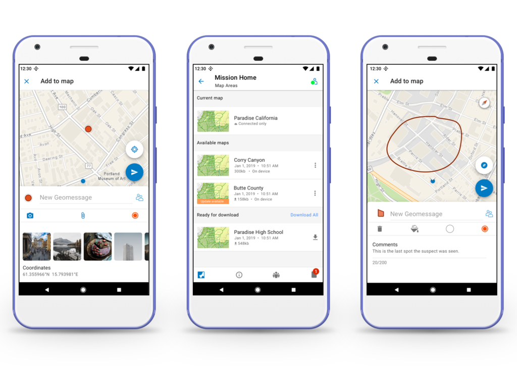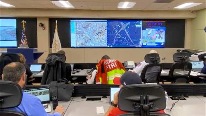
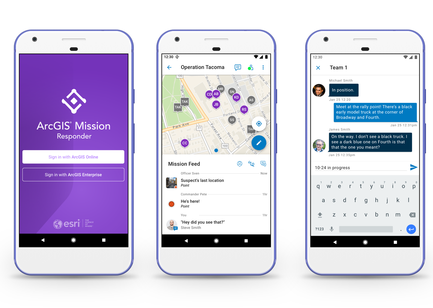
What is ArcGIS Mission Responder?
A life-saving app that provides fire and law enforcement agencies with situational awareness through mapping technology and chat communication.
Details
This enterprise-level software called Missons has three components: Mission Manager, Mission Server and the mobile app, Responder.
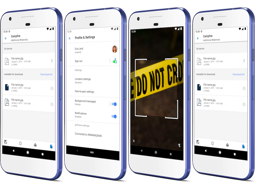
Responder allows users to see other mission members on the map, chat with them, and broadcast a location, such as "Suspicious backpack is here".
This was the first app with a chat feature that Esri produced. Responder differed from any competitive product because of its ease of use and ability wor work with Esri's superior geographic information system.
Process
With Responder, our goal was to provide situational awareness at a glance, so operators could focus on the mission at hand. This was an enterprise-level product to be supported in multiple languages such as German, Russian and Japanese. I was brought on to the project to quickly design product features while productions was already underway.
I relish the challenge of designing the product from its infancy because it game me the opportunity to bring my ideas to the table and see them through the final release.
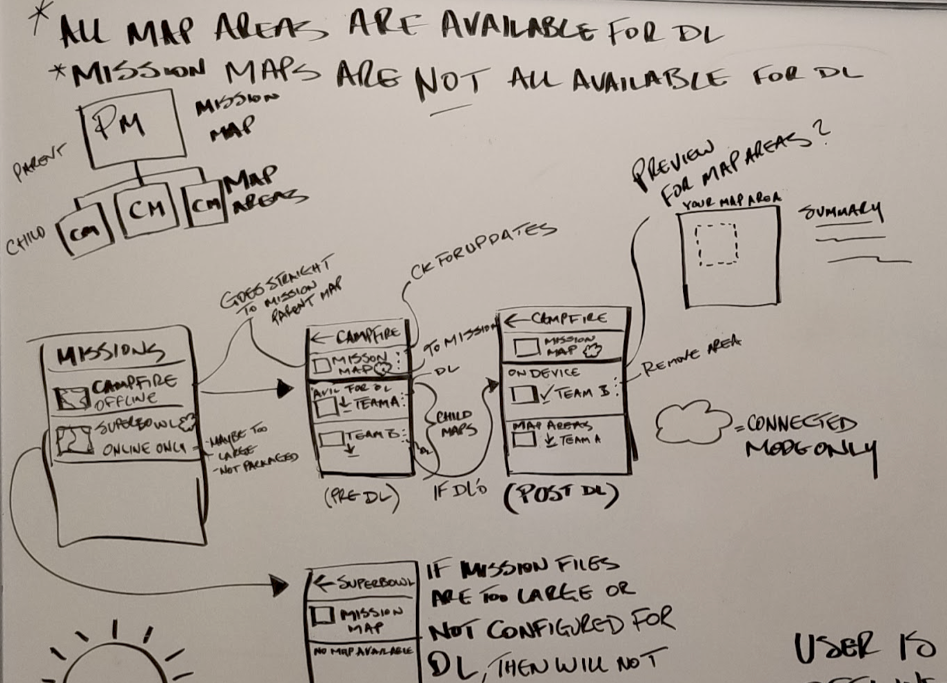
I was the only designer on the project working closely with the product owner, as well as, android and iOS developers, on discussing feature flows and overall user experience.
I worked extremely close with developers to ensure design specs were met and that the design vision was executed correctly.